Table of Contents
Let us be honest, one of the main reasons people come to places like Denali is to get boots on the ground and explore the hiking trails that lead to mountain peaks, and backcountry tundra. Not only does it get you in touch with nature, and give you a decent work out, it is also one of the best ways to really savor the spectacular views that the area has to offer. With Denali being such a big place, it can be tough for someone know where to start when it comes to hiking, which is why I decided to put together this list from my years of living here. All these trails can be found in even more detail on the app AllTrails (mentioned in our previous blog post Best Travel Apps for Alaska).
Savage River Trail
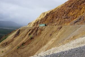
Of all trails on the list this one is undoubtedly the easiest. Do not take that as a reason not to investigate it, because the payoff that you get from the short loop section ends up giving you one of the best values tradeoffs for your trail time. Additionally, for those seeking a bit more of a challenge, you can do the loop and the optional alpine section of the trail that leads you up a mountain to view the river valley below. The trail head is located at the 16-mile marker of Denali National Park, the furthest you can drive a personal vehicle into the park. Once you get to the parking lot, you will quickly spot the trail running right alongside the Savage River. The loop is 2.1 miles long, and only gains about 413 ft throughout the hike. The whole journey runs close to the powerful Savage River, whose sound of rushing water fills the valley like a chorus in a stone amphitheater.
For the people seeking the alpine section of the trail, you will find it as soon as you hop onto the trail from the parking lot. Unlike the loop, this trail is 4.1 miles and gains 1,414 ft. towering above the valley below. It is also a point to point and will not bring you back to where your car was parked, though a shuttle is available from the end point at the Savage River Campground to the parking lot of the trail. Besides offering a beautiful view, this section of trail will also lead you through a section of rocks that offer an interesting close-range spectacle, and a limited bouldering area for those who might be in search of that. Plan for at minimum 2 hours for the average hiker.
Triple Lakes
Triple lakes, like the Savage River Alpine Trail, is a point to point. One direction will carry you about 9.5 miles, and will gain anywhere from 1,000 ft to 3,000ft. The most common way for people who live around the area is to tackle this trek, is to take a personal vehicle to the trailhead on the George Parks Highway near the Grizzly Bear Resort, and The Village. From there, you hike up the trail head, crossing over the railroad line, and up into the mountains. If you do the hike from this direction, the three lakes in the Triple Lakes will be stacked in your direction. If you instead were to do it from the visitor’s center in the park the lakes would be at the end of the trail. One of the things that I’ve always loved so much about this hike, is that during the right time of the summer, there are bushels of wild berries growing all along the trail side, as well as having the perfect mixture of alpine ridge hiking, shaded sections under the canopy of the boreal forest, and waterside walks that help to attract all manner of wildlife.
Two important things to keep in mind as you plan for this hike is
- The trail does run inside of the park boundary, even though it may not feel like it when you start from the section on the highway, which means that all the national park rules apply to the entirety of the hike.
- If you are planning to hike this trail just one direction instead of doing a roundtrip hike of almost 19 miles, you’ll need to arrange a way to get back to your vehicle. If you are staying at one of the hotels near the highway side of the hike, check in with them to see if you can arrange for a shuttle ride back from the visitor’s center, or park one car at the visitor’s center, and one on the road to guarantee your return.
Mt. Healy at Bison Gulch
Do not get this hike confused with the Healy Overlook Trail that starts inside the National Park. While that is a fantastic walk, the Healy Overlook trail from Bison Gulch is more of a challenge by most reports. This hike is a strait shot up the mountain, 3.5 miles up and 3.5 back down. Unlike similar hikes you might find in other parts of the country, there are no switchbacks on this trail, instead offering a well-worn game trail all the way to the top of Mt. Healy’s castle rock summit. Getting to the summit will take you 3,868 ft. of gain. Most people plan around 5-7 hours for this hike depending on ability, so for most it will be the one activity the do for that day. Parking at the base of the trail is simple, and just across the highway from the from the trail itself. Head north past the Nenana River crossing at Windy Bridge and look for the roadside sign that says Bison Gulch. If you are North bound, the parking lot will be on your right.
This hike is amazing, and challenging, the views from the top span all the way from Denali itself to the horizon where you lose track of the Alaska range. Bring water, food, and a camera on this hike for sure, and keep track of the weather. The journey will take you to well within cloud range and is a less than ideal spot to find yourself caught if there is a storm rolling through. If you complete it, you will be one of the small percentages that do in any given summer, as this hike is intimidating for most people visiting.
Kesugi Ridge
Of all the hikes we have put on the list, this is the only one that will take you more than one day to complete. Located in Denali State Park, this 29.2-mile point to point covers 5,990ft of gain and will take you throughout the entire North to South boundary of the state park. Like most the hikes on this list, the best time of year to take a swing at this hike will be during the peak summer months. This trail is comprised of a collection of other trails as well, so to find the start point you will want to look for Little Coal Creek on the North side of the park. The end point is at Byres Creek Campground for most people, but there is an additional 12 miles available for hiking if that is something you are wanting to do.
Things to keep in mind for this journey is that the hike is mostly in alpine territory so shelter from the elements is limited, as well as sun exposure will be something that you will have to factor in. The few lakes along the way will over a welcome respite to you on particularly warm days, so if you can predict it, it will pay off. This trip will offer unparalleled view of Denali and will offer a much more casual experience that is offered by the state park. Be mindful that like in most areas of Alaska, this is bear territory, and 2-4 days of trail time will up your odds of running into some of Denali’s larger wildlife so plan accordingly.
Horseshoe Lake
The final trip on our list brings us back into the National Park. Horseshoe lake is one of the first hikes you will come across as you enter the park and comes well before the visitor’s center. A parking lot is situated on the right side of the road, close to the train tracks, and will set you on the right direction towards finding one of Denali’s most well-maintained trails. The trail has steps built into it that will allow for easier treks during the descent and ascent. Once you get to the bottom, you will find yourself hiking the shoreline of a beautiful blue body of water, inhabited by beavers, moose, birds of all variety, and even the occasional bear. The Mountainside whose shadow you will often find yourself in towers above the whole valley offering a spectacle no matter where you are on the trail. Hike along to find bridges that connect footpaths over creek crossings and wander off the trail a little to get along the shoreline of the mighty Nenana River. The hardest part of this trip will be the hike back out, which does include the trail stairs. At the end of the day, the 2.1-mile hike is considered easy, and has one of the highest volume of ratings by users on AllTrails. Plan for a minimum of 45 minutes, though you could spend an entire day in this area if you enjoy yourself!
Share this article: